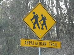
Just a short hike today, about 5.5 miles. But, we pass two mines, a memorial plaque to George Goldthwaite, and Times Square.
We start our little adventure by taking Route 17 north to Sloatsburg, make a right onto Seven Lakes Drive. Follow Seven Lakes Drive for about 8 miles to the parking area for Lake Skannatati, on the left.
From the parking area, find the aqua-blazed Long Path. The Long Path runs along the north shoreline of the lake for about ten minutes before crossing Pine Swamp Brook. After about a mile the Long Path meets a junction with the yellow-blazed Dunning Trail. The two trails run together for a while then split. At the split, begin to follow the yellow-blazed Dunning Trail.
When you reach the base of the descent, you will notice some stone foundations to the left, these are remains of the Hogencamp Mine village. To the right is a vertical mine shaft, 25 feet in diameter. The shaft is filled with water and seven inch cast iron pipe is sticking out of it. Opposite of this shaft you will see concrete with iron rods and a stone well, about three feet in diameter.
Following the yellow trail, further up from Hogencamp Mine, again we find an unnatural rock pile (we're getting good at this) on the right. A short climb off of the trail and we find a huge pit (much cooler than my description), which we assume is left over from the Hogencamp iron ore mine.
Continue on the yellow-blazed Dunning Trail as we pass Pine Swamp on the left. The trail inclines moderately at a fork in the trail, bear to the right and continue on the Dunning Trail.
After about a mile on the Dunning Trail and another moderate incline, we come to an area of a bare rock with huge boulders known as "Bowling Rocks". Follow the trail down a descent and up again, passing a tree planted in a rock-based planter, soon after we junction with the red-on-white-blazed Ramapo-Dunderberg (R-D) Trail. The yellow-blazed trail continues forward as the red-on-white blaze turns right.
We now follow the R-D Trail as it climbs over a huge bare rock known as Whaleback (watch out for little dogs here, just kidding, L&O, you know what I mean). If you are hiking during the winter months, this area is very icy and requires crampons. As you leave the Whaleback, there is a rock to the right with the plaque placed in memory to George E. Goldthwaite by the Fresh Air Club of New York. George E. Goldthwaite was said to have hiked the entire 21-mile R-D in less than five hours!
The trail now descends a rock face and crosses a stream over a log bridge (more like wood boards), passes a junction with the blue-blazed Lichen Trail, then passes under a overhanging rock, known as "Ship Rock".
The trail continues as we climb Hogencamp Mountain, a bare rock summit of 1,353 feet, one of the highest spots in Harriman State Park. The trail takes a sharp right turn and begins a steady descent, entering a forest.
At the base of the descent, you'll reach "Times Square", marked by a fireplace next to a huge boulder. Named so because this is the junction of three popular trails. Turn right at the boulder and begin to follow the red-triangle-on-white-blazed Arden-Surebridge (A-SB) Trail. The A-SB runs together with the Long Path, but within a few feet, turns left and begins a steady descent. In half a mile it reaches the northern end of the yellow-blazed Dunning Trail, where it crosses a stream (continue on the red-triangle-on-white A-SB Trail).
Just after crossing the stream, look to your left and you will notice a large cut-out in the hillside (pictured above). This is part of the Pine Swamp Mine. A search around the area will uncover more excavations and open pits, please be careful!
After playing in the area (L&O!) the trail bears right and descends into the woods as we pass remnants of a stone wall and foundations to the left of the trail. This was once the village that housed the workers of the Pine Swamp Mine.
The A-SB then passes the northern end of the Pine Swamp and begins a steady climb of the Pine Swamp Mountain (it sounds bad, but it's not). Just beyond the summit, a view overlooking the Lakes Skannatati and Kanawauke offers a Kodak moment. We pass a junction with the Red Cross Trail as the A-SB makes it's final descent back to the parking area where we began.


3 comments:
Very nice blogging! The use of more then one crampon is advised! I'd like to retrace our steps in the Spring and check out the shelter and see what the Whaleback really looks like....
Thank you! That was a tough blog, not much to say, yet VERY cool hike!
Yes, two crampons are advised, but we learn first and pass it on (though I suspect most people would have figured that one out on their own!). I really want to do this in the Spring, it was an overall excellent hike!
Lol you copied the NYNJTC hike description including the errors!
Post a Comment