
Thanks L & O!
High Tor, Little Tor and South Mountain Park and Gurnee County Park
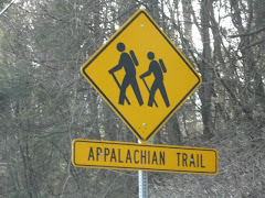
All Long Path
Map 112-Hudson Palisades Trails
7-1/2 miles
With my irreplaceable hiking partner “Northeast Hiking” diligently earning her degree in Ecology, I am sadly hitting the trails without her. I parked my car on a turnoff on Route 9W and Route 304 and crossed Route 9W to connect with the Long Path. The first mile or so is mainly road walking (Scratchup Road), however, the trail is surrounded by beauty on both sides; an apple orchard and the amazing rock cut from the Tilcon Quarry. I also spotted a few deers in the orchard. I followed the Long Path until it reached Old Route 304, then I followed the LP blazes as they turned right off the road and steadily climbed toward High Tor Mountain. The renowned author/playwright Maxwell Anderson, a long time Rockland County resident wrote a play entitled High Tor after the mountain. After a long climb, I encountered the Spur Trail, which leads to the historic High Tor Vineyards. I trudged along, opting to go explore the Vineyards another day. Steadily, I climbed until I reached High Tor Mountain. The views were amazing, and included the Hudson River and the Village of Haverstraw. During the American Revolution, the troops used High Tor Mountain as a place to signal. There are the remains of an old radio tower and lots and lots of graffiti. I descended High Tor Mountain and followed the LP to a lovely woods road. I followed the woods roads for what seemed to be two miles and found the White Trail which leads to Little Tor. The view from Little Tor was not as dramatic as High Tor, but well worth the short hike. I doubled back to the Long Path and continued on the woods road until I reached Central Highway. I crossed Central Highway and continued on the Long Path. The trail here gets more technical and steadily ascends. The ascent brings you to the Gurnee County Park with its amazing vistas. Although the signs posted on the trees warned me to “Do Not Approach, Ground Unstable” I took a peek and was rewarded with a view of the Rampo Mountains and Harriman State Park. The Long Path descends pleasantly to Gurnee County Park. I followed the Long Path onto Route 45 and rewarded myself with a nice breakfast at the Mt. Ivy Diner.


4 comments:
A couple of typographical errors, but not so bad...Thanks for letting me blog!
Sorry about that, I make a terrible editor! But I fixed them, no worries! Great post!
So I don't get any credit for picking you up in the Mt. Ivy Diner parking lot? LOL. Good job on the blog, L&O.
Really nice description of the track. I really like tracks where the landscape is changing. At first, an apple orchard, and then suddenly a real nature - big trees, lake, etc.
Post a Comment