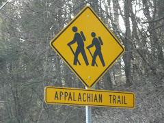
Here's a video from Old Goat of his Appalachian Trail adventure, I found it on YouTube. Anyone interested in reading more from Old Goat himself can find it here: http://www.trailjournals.com/chipsadventure
Friday, November 30, 2007
Old Goat's Appalachian Trail Adventure
Thursday, November 29, 2007
Hiking Etiquette

I stumbled upon a great article by Hiking Dude on his website about hiking etiquette that I wanted to share!
Wouldn't it be nice if everyone using the trail would follow these basic rules?
Thanks Hiking Dude, great article!
Tuesday, November 27, 2007
Bear Mountain

In 1908, New York announced plans to relocate Sing Sing Prison to Bear Mountain. The state actually began work on the building after purchasing 740 acres of land in 1909. Enter Mary Averell Harriman (widow of Union Pacific president, E.H. Harriman). Mary proposed to the then Governor of New York, Charles Evans Hughes, that she would donate 10,000 acres of land and $1 million for the creation of a new state park, but only if the plans for the prison were abandoned. George W. Perkins, head of the newly formed Palisades Interstate Park Commission, raised another $1.5 million, thanks to dozens of wealthy contributors including John D. Rockefeller and J. Pierpont Morgan. The state accepted, and on October 29, 1910, New York was presented with the deed to the land and a check.
In 1912, Major William A. Welch was hired as the Chief Engineer. By 1913, Major Welch (later to be recognized as the father of the state park and the national park movement) began the construction of the road that would link Bear Mountain to Sloatsburg, known today as Seven Lakes Drive. Major Welch also served as the Chief Engineer/General Manager of the newly formed park from 1910 to 1940.
The park opened on July 5, 1913 bringing 22,000 visitors by steamboats alone that year. By 1914, an estimated 1 million people a year were visiting the park. Winter sports were added in 1928, in fact, by 1960, more ski jump competitions were held at Bear Mountain than any other area in the United States. Unfortunately, the ski jumps have been closed since the 1970's.
The first section of the Appalachian Trail, from Bear Mountain to the Delaware Water Gap, opened on October 7, 1923. The portion of the trail that passes through the Bear Mountain Zoo is the lowest point in the 2,170 mile hiking trail. Major Welch also served as the first chairman of the Appalachian Trail Conference. He is credited with designing the "A over T" marker that became the symbol of the Appalachian Trail.
On to our hike!
Beginning at the Bear Mountain Inn (will it ever reopen?), head west to reach the red-dot-on-white-blazed Major Welch Trail. The trail follows the shore of the Hessian Lake, offering a nice view of the lake. At the north end of the trail, bear left to ascend the northern slope of the mountain. The path inclines sharply and the rocky path becomes increasingly difficult as you climb. The footpath climbs a vertical distance of about 500 feet in roughly a quarter of a mile.
After climbing for what seems to be an eternity, the trail levels off to it's first panoramic view. Brooks Lake can be seen directly ahead with Bear Mountain Bridge and Anthony's Nose behind it to your right. Take a break, drink some water, eat some turkey jerky and take a lot of pictures.
Although you might feel like you are at the top of the world, you are not and it's time to continue onward! Leaving the false summit, continue to climb the steep ascent until you arrive at the stone wall and Perkins Drive.
Nope, not there yet! Turn left and follow the road, then turn right continuing on the trail through the mountain laurel. Once at the true top, the trail levels off to a gravel road leading through more laurels where it joins a paved road. From here, it is only a short walk to Perkins Memorial Tower (named after the first president of the Palisades Interstate Park Commission). Bring quarters to refill on fluids from the vending machines!
Continue past the tower to a scenic view. From here head back to the tower, but bear right at a large boulder. You will see a plaque honoring Joseph Bartha as Trails Chairman of the New York-New Jersey Trail Conference. To the left we pick up the Appalachian Trail, marked by a white vertical rectangle.
Bear right and descend the mountain passing an old water pipline resting on a rock embankment. After only a short distance, the trail crosses Scenic Drive. Continuing to descend, we cross Scenic Drive again.
About a half mile from the mountain summit, the trail will cross Scenic Drive for the third time. Here, it turns right and follows the road. At the dead end turnaround, bear to the right and follow the trail to the left as it leaves the road (the pavement is marked with "I-HR"). Pass through a pine grove, then the trail begins to descend more steeply (note: due to extensive use, this section of the trail is heavly eroded and poorly marked. The AT is under a massive relocation of this section, but not expected to be completed until about 2011).
Follow the Appalachian Trail for about another mile until it joins the yellow-blazed Suffern-Bear Mountain Trail. Both trails cross a stream and turn sharply right. Continue to follow the road, crossing behind the skating rink (to the right) and an abandoned ski jump (to the left), descending to reach the junction behind the Bear Mountain Inn where our adventure began.
Whew! Climbing 1,305 feet and back sure does wear a person out! But almost 10 miles and 3 hours and we're feeling great!
For directions to the park and more information: http://www.nysparks.state.ny.us/
or call (845) 786-2701
Tuesday, November 20, 2007
The Freedom Trail- Boston City Tour Part 2

Whew! I feel much better! Now onward we go!
Heading north on Congress Street, continue until the buildings open and you arrive at Faneuil Hall. Here, Faneuil Hall hosted America's first Town Meeting. Built by Peter Faneuil in 1741, this building is often referred to as "the home of free speech" and "the Cradle of Liberty". It was within these walls where the Sons of Liberty proclaimed their dissent against British royalty. Also, Boston's first marketplace, a tradition that carries on to this day. Between May and October there are ongoing street performers daily, please stop and support.
I promised you chowda right? Follow the red trail around Faneuil Hall to Union Street. You needn't walk far until you arrive at America's oldest restaurant, Union Oyster House, established in 1826. It will be the best clam chowder you have ever tasted. Oh, yeah, ask for a toothpick while you are there. It was here that they were first used in the United States (can't let the trivia buffs down!). For a thirstier bunch, visit the Green Dragon Tavern right next door.
At the end of Union Street, turn right onto Hanover Street. Don't loose the red trail, it gets a little tricky here. Turn right onto Richmond Street, then left onto North Street. At 19 North Street we arrive at Paul Revere's House. Built around 1680, it is the oldest remaining structure in Boston and the only home on the Freedom Trail.
On the road again! Continuing to follow the trail, it's back to Hanover Street, cross through the Paul Revere Mall to reach the Old North Church. One of the most visited sites in Boston, it is also the city's oldest church. On April 18, 1775, Robert Newman climbed the steeple and hung two lanterns as a signal from Paul Revere that the British were marching to Lexington and Concord to arrest Samuel Adams and John Hancock.
Hiking north to Hull Street, be sure to stop by Copp's Hill Burying Ground. Here you will find the final resting place of Cotton and Increase Mather of the Salem witch trial fame and the lantern man, Robert Newman.
From here we cross the Charlestown Bridge, built in 1899. Once over the bridge, turn right and follow Constitution Road. Follow the signs to the Bunker Hill Pavilion. This is a privately owned show about the first battle of the Revolution, fought here in 1775. The visitor's center shares the building with the Charlestown Navy Yard. The Navy Yard was decommissioned in 1974 and is now maintained by the National Park Service (tax dollars well spent for a change!). Here you will see "Old Ironsides", the oldest commissioned warship afloat in the world. Officially known as the USS Constitution, she received her nickname during the war of 1812.
From the USS Constitution, you can certainly see our final destination, the Bunker Hill Monument. Follow the red trail up Chestnut Street, then past Winthrop Square, finally connecting to Weslley High Street. "Don't fire until you see the white of their eyes!", an order believed to have been given by Colonel William Prescott during the famous battle fought on this site on June 17, 1775.
This historical hike can be taken self guided, with a costumed guide, or with an audio guide. While I enjoy, sometimes crave, the feeling of a dirt path, nothing compares to the feeling of walking the same path as my forefathers did, my journey was theirs. I encourage everyone reading this blog to walk the Freedom Trail just once, or like me several times (it never gets old), words in a book will never compare to standing in the same spot that these great Americans did. Their cries of freedom ring as true today as it did so long ago.
For more information, please visit: http://www.thefreedomtrail.org/
Monday, November 19, 2007
The Freedom Trail- Boston City Tour Part 1

Not all hiking is done on dirt, city hiking can be rewarding as well as educational. Boston's Freedom Trail can be just as challenging to the body as any National Park.
For newcomers to Boston, this walk is well marked by colored lines painted onto the streets and sidewalks, but you'll want to stop by any visitor center for a more detailed map.
Beginning in the heart of Boston, on Tremont Street, the Boston Common is America's oldest park. These 44 acres were once used as a common pasture for grazing cattle owned by the townspeople of Boston. Reverend Martin Luther King spoke here, Pope John Paul II said mass here, and Gloria Steinem advanced the feminist revolution on these grounds. After a walk across the Commons to Beacon Street, you will find the world famous "Cheers" bar. Stop in for some pictures, or just to say hi to Sam.
Continuing east on Beacon will bring to to the next stop, the State House. Completed on January 11th, 1798, this building was designed by Charles Bulfinch. It's gold dome, once made of wood, was later overlaid with copper by Paul Revere. And for all you trivia buffs, the land was originally used as John Hancock's cow pasture!
At the end of Beacon, turn right, onto Park Street. At the corner of Park and Tremont, you will find Park Street Church. This church was built in 1809 and boasts a 217 ft steeple. It is here that Samuel Francis Smith first sung "America" (My Country 'Tis of Thee) on July 4th, 1831.
Following Tremont Street north, you will come to the Granary Burying Ground. Buried here are: John Hancock, Paul Revere, Samuel Adams, James Otis, all five of the Boston Massacre victims, Benjamin Franklin's parents, Peter Faneuil and believe it or not, Mother Goose.
Just north of the Granary Burying Ground, on the corner of Tremont and School Streets, we find King's Chapel and Burying Ground. Built in 1688, it was a tiny church. So small, that by 1749, it's congregation outgrew the structure and a new one was built around it, to avoid disrupting the services. Paul Revere crafted the church's 2,347 pound bell in 1816.
Following the trail on School Street, you will pass the Benjamin Franklin statue and Boston Latin School. America's first public school, the Boston Latin School offered instructions to boys free of charge (girls remained privately schooled. The doors finally opened to the ladies in 1972). Benjamin Franklin was the most famous student tutored within.
At the end of School Street turn right onto Washington Street, southbound, for a detour to the Old South Meeting House. When 5000 angry colonists gathered here on December 16, 1773, they declared "no tax on tea!" and they started a revolution. Built in 1729 as a Puritan house of worship, it was the largest building in colonial Boston. More trivia: Benjamin Franklin was baptized here.
Turn right, heading now north on Washington Street to the corner of Washington and State Streets. Here, at the Old State House, you will find a simple building, with a simple balcony. It was from that humble balcony, in 1776, that the Declaration of Independence was first read to the people of Boston. Look around on the sidewalk, here you will find a marker for the Site of the Boston Massacre. It was on this spot on March 5, 1770, that the skirmish between a few "red coats" and a group of Boston citizens left five Bostonians dead.
Halfway through our hike and I'm beginning to tire. Tomorrow, we'll relax and grab some chowder before continuing on our hike into the past.
Subscribe to:
Posts (Atom)