Thursday, January 31, 2008

Claudius Smith Den


This hike brings us back to a time of outlaws and hideouts.

Claudius Smith and gang (including his three sons) terrorized southern Orange County, NY during the Revolutionary War from 1774 to 1779. The British sympathizer first stole horses and cattle to sell them to British troops, then began raiding homes and farms. At times they even burned the homes and murdered the occupants.

They hid out in the rocks in what is now Harriman State Park. The upper chamber was used as their den and the lower chamber (pictured on the left) was used as a horse stable.

As traitors to their country, the gang hijacked the arsenal trains of the Continental Army and was suspected in the murder of Major Nathaniel Strong on October 6, 1778. This act prompted then NY Governor George Clinton to offer a $1200 reward for the capture of Smith (www.northjerseyhistory.org/history/smith/claudius.htm). Smith was indeed captured and hung on January 22, 1779. Nope, crime never pays.

And so we begin! First, take the NY Thruway to exit 15A, at the end of the ramp turn left at the light and continue on Route 17 North. After about 4.5 miles you will see the Tuxedo Train Station on your right. Continue past and make the next right over the railroad tracks and park in the left commuter parking lot (this is free parking on the weekends and holidays).

Now, you might hear that this is a moderate hiking trail, well my friends, after hiking this loop twice, I'm here to tell you it isn't. But while it is a hard 8 miles, the views are spectacular and extremely rewarding.

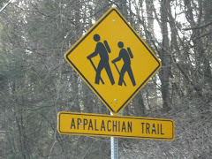
When you're ready, walk out to the road from the lot and turn left, you will see a red-dot-on-white trail marker (Ramapo-Dunderberg Trail) on a wooden sign. This is where we begin. Follow the winding road as it passes through a tunnel under the highway. Follow the RD trail markers as the road turns left and continues to the base of the mountain.

Follow the RD trail as we climb the mountain over a rocky trail on switchbacks for a 500 foot vertical climb (aren't they all in NY?). After the trail levels off, you will see the yellow-blazed Triangle Trail continue straight, but we want to bear right and continue on the red-dot-on-white blazed trail.

Our first scenic stop comes soon after we make that turn. On the left you get a spectacular view of the town of Tuxedo and the NY Thruway. But, we have a lot of trail ahead of us! Continuing on the RD trail, pay close attention, on the right you will seen an unnatural pile of rocks (see right picture), if you leave the trail and walk around the rocks, you will find the Black Ash Mine!

After leaving the mine, keep following the RD trail until you come to signs for the blue-disc-blazed Victory trail. At this point, look to your left and continue to follow the RD trail sharply up the mountain.

After hiking for awhile, you will cross the White Bar trail. Keep going until you once again meet with the yellow-blazed Triangle trail. Here, turn right onto the yellow trail and work your way down the mountain. Soon after you turn onto the yellow, you will come to a spot where you turn right and have to step down a rocky natural step. If you look right, you will see a bear den, best to leave it alone (right L&O!!).

Follow the uneventful yellow-blazed trail until you reach Lake Skenonto. Relax and take a well deserved break, we are now more than half way through our loop!

When you are ready, follow the trail back out, but this time, turn left onto the blue-blazed Victory trail. This vintage looking trail is an old service road, yet it is anything but easy. Continue on it until you reach the point of intersection with the RD trail. Once here, follow the blue-disc-blazed trail to the left and over a stone bridge across the small stream leading from the Black Ash Swamp.

The blue-disc-blazed trail will lead you to the Claudius Smith Den overlook. Soon after the overlook, the blue-disc ends and we pick up the red-blazed Tuxedo-Mt. Ivy trail. It is the red-blazed trail that will lead you right into the den.

Once you are finished exploring the "Cowboy of the Ramapos" former hideout, continue to follow the red-blazed TMI trail until its terminus, then make a left onto the RD trail once more, taking it back to the parking area.

Sunday, January 20, 2008

Sterling Forest Fire Tower


Just a short hike for today! A moderate hike of 4.3 miles to the Sterling Forest Fire Tower.
Take the N.Y. Thruway to exit 15A. Turn left onto route 17 north. In about 1.4 miles, bear right onto the exit for Sterling Forest. Follow Sterling Mine Road west for 3 miles, then turn right onto Long Meadow Road. Follow Long Meadow Road for 3.5 miles, then turn left onto Old Forge Road and continue on for .5 mile until your reach the Sterling Forest State Park Visitor's Center on the right. Park in the lot across from the visitor's center, then cross the road to the center.
After a look around the center and gift shop, we begin our hike at the front entrance. Walking out of the center turn right and follow the dirt path, following the blue-blazed Sterling Lake Loop. We pass the remains of a church on the right before entering the wooded area. Follow the blue-blaze through the woods and over a footbridge. If you pause on the bridge and turn left, you can see the remains of the Sterling Furnace through the trees.
Continue to follow the blue-blazed trail over a woods road and then as it turns left and descends onto a footpath. Soon we reach the paved West Sterling Lake Road. Turn right and follow the trail pass the brick ruins on the left and Sterling Lake on the right.
Shortly, the road curves to the right, as we continue, a sign marks the beginning of the Bare Rock and Fire Tower Trails. Turn left off of the blue-blazed trail and then immediately right onto the orange-blazed Bare Rock Trail. Follow the orange-blazed trail as it ascends the woods road, climbing steeply for about .75 mile. At the crest of the ridge, a sign marks the junction with the blue-on-white-blazed Sterling Ridge Trail.
Turn left and now follow the blue-on-white-blazed Sterling Ridge Trail and the teal diamond blazes of the Highlands Trail. This a an easy hike with many viewpoints.
About a mile from the trail sign, you'll reach a ranger cabin and the Sterling Forest Fire Tower. The tower is open on weekends and holidays when a ranger is present. Call ahead or ask at the visitor's center if it will be open.
The Sterling Forest Tower is a 60' Aermotor LS40 with a 7' x 7' steel cab. It was erected in 1922 and operational in 1923. It ceased operation in 1988 and closed in 1989. It was held as a "stand-by" tower until 1999, when it was put back into active service. Today, it is the only active fire tower in New York State.
There are picnic tables at the base of the tower if you would like to take a break, or just hang for a while.
When you are ready to leave Rough Mountain and the tower, head east on the red-blazed Fire Tower Trail (do not take the joint Fire Tower/Sterling Ridge Trail marked on the sign). The red-blazed trail follows a service road. After about a half mile, the road levels off as you come to a junction. The rectangle red-blazed trail turns off on the right, but instead, continue ahead, now following the red-triangle blazes. The road continues to descend until you reach a locked gate ahead and houses in front and on the right. Walk around the gate and turn right onto the paved road. Here we pick up the blue-blazed Sterling Lake Loop Trail, this time following it back to the visitor's center.
Although this is a short hike, the views are incredible and the hike is relaxing and enjoyable. As always, this Sterling Forest State Park Trail does not disappoint.

Lemon Squeezer/Boston Mine Loop


Last week, Law & Order and I hiked a 7.5 mile trail that included Green Pond and Island Pond Mountains, the famous Appalachian Trail rock formation, known as the Lemon Squeezer and the historic Boston Mine. It was a great day for hiking!
Our adventure begins at the parking area next to a meadow known as the Elk Pen (named so in 1919, when about 60 Elk were brought from Yellowstone Park in hopes of populating this area.). Walk the unmarked trail through the meadow and turn right at the end. In about 100 feet you will come to a wooden mileage sign for the Appalachian Trail. Turn left and follow the A.T. up the Green Pond Mountain. The climb is a moderate, then strenuous 500 foot ascent. After the summit, the A.T. descends the mountain at an easy pace.
At the eastern base of Green Pond Mountain, the A.T. turns left onto Island Pond Road, a dirt road built by Edward Harriman about 1905. Shortly after, the A.T. turns right and crosses a gravel road built in the 1960s as an access to Island Pond. You then cross an outlet of the pond over a small wooden bridge.
Continue to follow the A.T. through a knoll overlooking the pond. You will pass a large metal object on the right (this was once used to sort gravel). Shortly after passing the metal sorter, the A.T. turns left and climbs to a junction with the A-SB Trail (red triangles on a white background). Turn left at the junction and follow the dual trails to the base of a large rock formation where the two trails split.
Continue on the white blaze trail through the rock formation, known as the Lemon Squeezer. This narrow passage is one of the most famous landmarks of the Appalachian Trail. After squeezing through (I'm not kidding) the rocks, you will walk right into a steep rock face (again, not kidding). This is definitely a challenging obstacle to navigate yourself over. Those who cannot maneuver this, can bypass it by taking a short side trail to the left.
After the Lemon Squeezer, the trail levels off to a nice hike to the summit of Island Pond Mountain. The stone ruins right after the summit are remains of Edward Harriman's cabin. Take a break and enjoy the view.
The A.T. descends the mountain and passes through a hemlock grove before reaching a junction with the Long Path. The junction is marked by a wooden signpost (seen at the top left of this post). Say goodbye to the A.T. (by the way, you have just hiked the first few miles ever blazed on the Appalachian Trail...pretty cool...). Now follow the aqua-blazed Long Path. The Long Path follows the Dismal Swamp edge (nope, not kidding, and yes, it's pretty dismal). After what seems to be a long, dismal walk, you will come to a woods road marked by three horizontal white blazes. Yell "hallelujah!" and turn right onto the White Bar Trail.
After about a mile, the yellow-blazed Dunning Trail joins the White Bar Trail from the left. Continue ahead, following both trails, but when they separate about a quarter of a mile later, turn right and follow the yellow-blazed Dunning Trail.
Once on the Dunning Trail, there are a lot of ups and downs over rocks. When you descend from what seems to be the largest (also the last) the path bears right. Turn again right and enter the Boston Mine. SO COOL! Although the mine is filled with water, it is definitely reward enough for the climbing we just did! This mine was last worked around 1880.
We sadly leave the Boston Mine and continue back on the yellow-blazed Dunning Trail, but only for about 500 feet. We reach a wide woods road and turn right onto it. Follow the unmarked Island Pond Road through hemlock and laurels. When you come to the A-SB (red triangle on white blaze) continue ahead and bear right at the fork. At the next intersection, again bear right. After a short walk you will arrive at the remains of a stone building. This was once a ranger station. Hang out, eat a snickers bar, and explore the area. There are great views of the pond from this area.
When you're ready, retrace your steps on the unmarked road, this time bear right at the intersection with the A-SB Trail. Now follow the red triangle on white trail across the southern end of the Green Pond Mountain. After an easy hike through the wooded area marked by many felled trees, we begin our descent. By far the least enjoyable part of our adventure. The path down includes many switchbacks over rocks. The descent feels more like a rock quarry than a mountain. Use extreme caution and the use of hiking poles is recommended.
When you are safely off of the mountain, continue to follow the A-SB trail until you reach a grassy woods road (Old Arden Road), turn right and follow this road to the end of the A-SB marked by a triple blaze. Turn left and follow the path through the meadow back to the Elk Pen parking area where we started.
To get here take N.Y. route 17 north through Sloatsburg, Tuxedo, and Southfields. About two miles north of Southfields, turn right onto Arden Valley Road. Cross the bridge, then make the first right at the sign for hikers' trailhead parking. Park in the dirt lot next to the meadow known as the Elk Pen.

Tuesday, January 1, 2008

Tallman Mountain State Park- The Long Path


The Long Path starts at the George Washington Bridge and currently ends at John Boyd Thacher State Park in Albany County. The history of the Long Path begins in 1921, when Major Welch, General Manager of the Palisades Interstate Park, proposed a hiking trail from Fort Lee to Bear Mountain. Nothing was done, but similar hiking trails were proposed every few years. In 1933, W.W. Cady of New York City began blazing a trail from the George Washington Bridge to Lake Placid. Cady soon gave up a few years later, never passing Route 23 near Windham High Peak. In 1943, Alexander Jessup picked up the trail and blazed to Peekamoose Mountain in the Catskills. The trail was abandoned again, when Jessup died in 1944. The trail changed again in 1961, when Robert Jessen, Kurt Ramig and Michael Warren of NYC planned a 350-mile route from the GWB to Whiteface Mountain. The Trail Conference adopted the path in 1965, with some more changes. Then on September 28, 1971, the Long Path was dedicated as a National Recreational Trail.

I hiked the section of the Long Path that crosses through the Tallman Mountain State Park located in Rockland County off 9W. It's an easy hike, only about a 4 mile turnaround, but has nice views of the Hudson River for much of the trail.

Following 9W toward Piermont, continue until you pass the Tallman Mountain State Park entrance. Continue for another .25 miles, on your left will be a small parking area for the park. If you miss the lot, there is an easy turn around further along the road on the left side (it looks like an abandoned gas station).

Enter the trail on the gravel road, following the aqua Long Path blazes. Shortly, you will see the ruins of brick structures on your right, here, turn left and follow the Long Path. You will follow the path along elevated earth (or berms), through marshy areas. When the wide berm abruptly ends, turn right and continue on a narrower berm, following the aqua blaze.
The berm ends at the wide gravel bike path, cross over to continue the hike. The trail turns sharply left and offers views of the Hudson, Tappan Zee Bridge, and the Piermont Marsh. Cross a small stream and follow an old road marked by a stone wall on the left.
Exiting the wooded area, turn right onto the road and come to a picnic area with a comfort station. If you walk toward the back of the station, you will again pick up the path on the left with descends down steep stairs and over a bridge.
After the bridge, you will see the swimming pool and a wide view of the Hudson. After a picture opportunity, turn around and walk up the paved ramp leading to the traffic circle. At the circle, keep to the right to once again follow the path. The trail climbs steeply to the North Picnic area. Here, you will find amazing views of the mile long Piermont Pier and Tappan Zee Bridge to the north and the towns of Irvington and Dobbs Ferry across the river, with the Piermont Marsh directly below. Continue along the paved road for views of the village of Piermont below and Hook Mountain jutting into the river past the Tappan Zee Bridge on the left.

The Long Path bears to the right of the picnic benches and descends steeply. At the bottom, you can bear right and walk along the reeds of the Piermont Marsh on the Tallman Bike Path. Or you can turn around (like I did) and climb back up the stairs to follow the Long Path back to the start.

The park is well maintained and the trail is well marked. The 4 mile hike is moderate and enjoyable. Bring a lunch to enjoy the view at the North Picnic Area.