
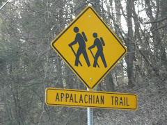
Last week, Law & Order and I hiked a 7.5 mile trail that included Green Pond and Island Pond Mountains, the famous Appalachian Trail rock formation, known as the Lemon Squeezer and the historic Boston Mine. It was a great day for hiking!
Our adventure begins at the parking area next to a meadow known as the Elk Pen (named so in 1919, when about 60 Elk were brought from Yellowstone Park in hopes of populating this area.). Walk the unmarked trail through the meadow and turn right at the end. In about 100 feet you will come to a wooden mileage sign for the Appalachian Trail. Turn left and follow the A.T. up the Green Pond Mountain. The climb is a moderate, then strenuous 500 foot ascent. After the summit, the A.T. descends the mountain at an easy pace.
At the eastern base of Green Pond Mountain, the A.T. turns left onto Island Pond Road, a dirt road built by Edward Harriman about 1905. Shortly after, the A.T. turns right and crosses a gravel road built in the 1960s as an access to Island Pond. You then cross an outlet of the pond over a small wooden bridge.
Continue to follow the A.T. through a knoll overlooking the pond. You will pass a large metal object on the right (this was once used to sort gravel). Shortly after passing the metal sorter, the A.T. turns left and climbs to a junction with the A-SB Trail (red triangles on a white background). Turn left at the junction and follow the dual trails to the base of a large rock formation where the two trails split.
Continue on the white blaze trail through the rock formation, known as the Lemon Squeezer. This narrow passage is one of the most famous landmarks of the Appalachian Trail. After squeezing through (I'm not kidding) the rocks, you will walk right into a steep rock face (again, not kidding). This is definitely a challenging obstacle to navigate yourself over. Those who cannot maneuver this, can bypass it by taking a short side trail to the left.
After the Lemon Squeezer, the trail levels off to a nice hike to the summit of Island Pond Mountain. The stone ruins right after the summit are remains of Edward Harriman's cabin. Take a break and enjoy the view.
The A.T. descends the mountain and passes through a hemlock grove before reaching a junction with the Long Path. The junction is marked by a wooden signpost (seen at the top left of this post). Say goodbye to the A.T. (by the way, you have just hiked the first few miles ever blazed on the Appalachian Trail...pretty cool...). Now follow the aqua-blazed Long Path. The Long Path follows the Dismal Swamp edge (nope, not kidding, and yes, it's pretty dismal). After what seems to be a long, dismal walk, you will come to a woods road marked by three horizontal white blazes. Yell "hallelujah!" and turn right onto the White Bar Trail.
After about a mile, the yellow-blazed Dunning Trail joins the White Bar Trail from the left. Continue ahead, following both trails, but when they separate about a quarter of a mile later, turn right and follow the yellow-blazed Dunning Trail.
Once on the Dunning Trail, there are a lot of ups and downs over rocks. When you descend from what seems to be the largest (also the last) the path bears right. Turn again right and enter the Boston Mine. SO COOL! Although the mine is filled with water, it is definitely reward enough for the climbing we just did! This mine was last worked around 1880.
We sadly leave the Boston Mine and continue back on the yellow-blazed Dunning Trail, but only for about 500 feet. We reach a wide woods road and turn right onto it. Follow the unmarked Island Pond Road through hemlock and laurels. When you come to the A-SB (red triangle on white blaze) continue ahead and bear right at the fork. At the next intersection, again bear right. After a short walk you will arrive at the remains of a stone building. This was once a ranger station. Hang out, eat a snickers bar, and explore the area. There are great views of the pond from this area.
When you're ready, retrace your steps on the unmarked road, this time bear right at the intersection with the A-SB Trail. Now follow the red triangle on white trail across the southern end of the Green Pond Mountain. After an easy hike through the wooded area marked by many felled trees, we begin our descent. By far the least enjoyable part of our adventure. The path down includes many switchbacks over rocks. The descent feels more like a rock quarry than a mountain. Use extreme caution and the use of hiking poles is recommended.
When you are safely off of the mountain, continue to follow the A-SB trail until you reach a grassy woods road (Old Arden Road), turn right and follow this road to the end of the A-SB marked by a triple blaze. Turn left and follow the path through the meadow back to the Elk Pen parking area where we started.
To get here take N.Y. route 17 north through Sloatsburg, Tuxedo, and Southfields. About two miles north of Southfields, turn right onto Arden Valley Road. Cross the bridge, then make the first right at the sign for hikers' trailhead parking. Park in the dirt lot next to the meadow known as the Elk Pen.


2 comments:
Excellent writing my friend...can't wait until the next adventure. Maybe you should give a shout out to the Orange Top Diner...Good, quick, cheap eats after a day on the trail.
Thanks pal! Thanks again for joining in the fun! Not ready to give the Orange Top a shout out, but they do have damn good coffee!
Already looking into the next adventure...
Post a Comment