
The Long Path starts at the George Washington Bridge and currently ends at John Boyd Thacher State Park in Albany County. The history of the Long Path begins in 1921, when Major Welch, General Manager of the Palisades Interstate Park, proposed a hiking trail from Fort Lee to Bear Mountain. Nothing was done, but similar hiking trails were proposed every few years. In 1933, W.W. Cady of New York City began blazing a trail from the George Washington Bridge to Lake Placid. Cady soon gave up a few years later, never passing Route 23 near Windham High Peak. In 1943, Alexander Jessup picked up the trail and blazed to Peekamoose Mountain in the Catskills. The trail was abandoned again, when Jessup died in 1944. The trail changed again in 1961, when Robert Jessen, Kurt Ramig and Michael Warren of NYC planned a 350-mile route from the GWB to Whiteface Mountain. The Trail Conference adopted the path in 1965, with some more changes. Then on September 28, 1971, the Long Path was dedicated as a National Recreational Trail.
I hiked the section of the Long Path that crosses through the Tallman Mountain State Park located in Rockland County off 9W. It's an easy hike, only about a 4 mile turnaround, but has nice views of the Hudson River for much of the trail.
Following 9W toward Piermont, continue until you pass the Tallman Mountain State Park entrance. Continue for another .25 miles, on your left will be a small parking area for the park. If you miss the lot, there is an easy turn around further along the road on the left side (it looks like an abandoned gas station).
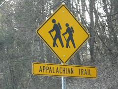
Enter the trail on the gravel road, following the aqua Long Path blazes. Shortly, you will see the ruins of brick structures on your right, here, turn left and follow the Long Path. You will follow the path along elevated earth (or berms), through marshy areas. When the wide berm abruptly ends, turn right and continue on a narrower berm, following the aqua blaze.
The berm ends at the wide gravel bike path, cross over to continue the hike. The trail turns sharply left and offers views of the Hudson, Tappan Zee Bridge, and the Piermont Marsh. Cross a small stream and follow an old road marked by a stone wall on the left.
Exiting the wooded area, turn right onto the road and come to a picnic area with a comfort station. If you walk toward the back of the station, you will again pick up the path on the left with descends down steep stairs and over a bridge.
After the bridge, you will see the swimming pool and a wide view of the Hudson. After a picture opportunity, turn around and walk up the paved ramp leading to the traffic circle. At the circle, keep to the right to once again follow the path. The trail climbs steeply to the North Picnic area. Here, you will find amazing views of the mile long Piermont Pier and Tappan Zee Bridge to the north and the towns of Irvington and Dobbs Ferry across the river, with the Piermont Marsh directly below. Continue along the paved road for views of the village of Piermont below and Hook Mountain jutting into the river past the Tappan Zee Bridge on the left.
The Long Path bears to the right of the picnic benches and descends steeply. At the bottom, you can bear right and walk along the reeds of the Piermont Marsh on the Tallman Bike Path. Or you can turn around (like I did) and climb back up the stairs to follow the Long Path back to the start.
The park is well maintained and the trail is well marked. The 4 mile hike is moderate and enjoyable. Bring a lunch to enjoy the view at the North Picnic Area.
Tuesday, January 1, 2008
Tallman Mountain State Park- The Long Path
Labels: New York, Tallman Mountain State Park, The Long Path
Subscribe to:
Post Comments (Atom)


3 comments:
Stop hiking without me!!!!!!!
Hey, pal. Maybe we can do some hiking this weekend! (Yes, L&R, you can come, too.)
LOL! L&O, you have to get up early to hang with me!
Tool- YES!
Post a Comment