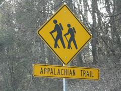
Just a small day hike today, just to get out and play in the nice weather. We started out in Harriman State Park on route 106 at an unmarked parking area (more like a pull-off), you will see yellow-blazes on the guardrails and trees. Using the NY/NJ Trail Conference map 118, we headed up the yellow-blazed Suffern-Bear Mountain trail on the same side as the parking area. What a great little hike! No rocks! Mountain laurel! Nice (this time of year with no leaves) views! In less than 30 minutes you will hike to the Orak Ruin. The ruin, as the story goes, was formerly the mansion owned by George Briggs Buchanan. Mr. Buchanan was the V.P. of Corn Products Refining Co. (the makers of Karo syrup). He named his estate Orak (Karo backwards) and seemed to be a quirky fella. When he built his dining room, he designed the floor to move like a ship's cabin, he even added portholes for windows. I'd give anything to go back in time to the 1920's, all the strange history seems to come from that era. We played there for a while, a lot of the foundation is still standing, but watch your step, there are a lot of old pieces of metal laying around. Back on the trail, where at times you can view the Hudson River, it's just a short hike to a fire tower. Now (this is where my love for Sterling Forest comes in), unlike the Sterling Forest fire tower, you can't get near this one. But, boy! is it big! After staring in awe of its size, we just followed the fire tower road back down the mountain until we met up with the yellow-blazed trail again. Retracing the trail back down, we stopped once again to play in the ruins, but this time, some small cabins across from the Orak ruin. Then we followed the trail back to the road, but now we crossed the road and followed the yellow-blazed Suffern-Bear Mountain trail the other way toward the "Irish Potato". Again, a very relaxing, easy hike. Just follow the yellow-blazed trail as it ascends Irish Mountain. At the summit, you will find the largest boulder you have ever seen, this is the Irish Potato. It's more impressive when you take a picture of someone standing next to it for proportion. After playing with the rock tripe on the boulder, we headed back down, following the yellow-blazed trail back to the car. Not a big hike, but I didn't break any bones, and in my book, that's always a good day.
Sunday, February 8, 2009
Orak Ruin
Tuesday, August 19, 2008
Gertrude's Nose
To hike the route we did, visit: www.nynjtc.org/trails/record/080703.html
Well, my favorite hike was the Ricketts Glen Falls Trail, I need a least favorite, and this would be it. Well, to be fair, it wasn't all bad, let me start at the beginning.
First, DO NOT attempt to park on State property before 9 am (even if the gates are open). I know you hikers like to get out early, but since NY can't tax it; they prohibit it. And, I think the High Point employees were helping out in NY the day we hiked. Yep, just plain not nice!
So, finally allowed to park, off we went. The hike to Gertrude's Nose was amazing. It was relaxing and well maintained with spectacular views. That's L&O in the picture to the left, it was a perfect day!
Then we left the cliffs. GRRR! When Gertrudes Nose Path ends and the Millbrook Ridge Trail begins the hike turns deadly (okay, no one died, but I did fall back on my pack and like a turtle I couldn't get up! That could have been bad). Seriously, for most of the hike back to the parking area the trail is not really maintained. The path is overgrown, not well blazed, and follows a water run-off trail, which means a lot of rocks and moisture, a deadly mix for sprained ankles.
Wait, sorry to interrupt, but I have to tell you this! A few weeks ago I requested that the house I live in get real recyclable containers from the county, so I wouldn't need to make my own anymore. Well, the genius from upstairs just came downstairs, once again, to argue with me that not only is recycling a scam, but polystyrene (a.k.a. Styrofoam) is the most biodegradable material on earth. LOL, welcome to my world! This is why I like to hike, it's peaceful, beautiful, and no (or very little) people! Okay, back to the hike!
Before you attempt this 8+ mile hike (some guides claim 8 miles, some 9), remember that you actually hike down to Gertrudes Nose, so on the last end of the loop, it's all uphill. Had you been hiking the day we were, you would have heard me complaining about this for at least 2 miles
A little background, Gertrudes Nose is a part of the Shawangunk Ridge (a.k.a. The Gunks). It's a ridge of mountains in Ulster County, Sullivan County and Orange County in New York extending from the northernmost point of NJ to the Catskill Mountains (and yes, High Point is included in the Gunks, it explains a lot, huh). Known for it's rock climbing, the ridge has also been designated by the Nature Conservancy as one of the "75 Last Great Places on Earth". I would agree with the last statement, it was beautiful, just not a great hike, there's a difference.
Wednesday, April 2, 2008
The Long Path: Blood on the Trail

The 326 mile Long Path begins at the Fort Lee Historical Park in New Jersey and ends at the John Boyd Thacher State Park in Albany County, New York (work is continuing to extend the trail north with a terminus in the Adirondacks).
Although every effort was made to keep the trail away from towns, the path travels through many, giving the hiker an intimate look at the heart of New York.
One such town that the trail passes through is the historic Nyack, the Gateway to Rockland County. Home to the Tappan Zee Bridge, a stop on the Underground Railroad, and the keeper of the Helen Hayes legacy, Nyack attracts many to its shore. Street fairs and celebrity sightings are as much a way of life to the residents as are the endless streams of tourists who overtake this small town every summer.
Following the Long Path through Rockland County will lead you through Tallman Mountain State Park (where the trail drops to the lowest elevation, a mere 5 feet above sea level), along 9W, through Blauvelt State Park (former home to a Nike missile launch site), then entering Nyack to cross the New York Thruway for the first time. It is at the intersection of Mountainview Avenue and Route 59, at the New York Thruway entrance ramp where blood was shed not so long ago on the Long Path.
It was on October 20, 1981 in the neighboring town of Nanuet, N.Y. where the unimaginable happened.
At approximately 3:55 pm, Peter Paige, a 24-year Brinks veteran, and his partner, Joe Trombino left the Nanuet National Bank, located on the second level at the Nanuet Mall. Exiting the mall, they used hand trucks to push the $1.6 million to their waiting armored truck. As they loaded the money into the truck, a red van drove up and the rear doors flew open. Masked men jumped out of the van, while one robber used a shotgun to fire 2 blasts into the bulletproof windshield, another robber opened fire with a M-16 automatic, killing Paige and wounding Trombino (Joe Trombino survived the assault and continued to work for Brinks until he was killed in the September 11 attacks in 2001, he was 68.). The thieves grabbed $1.6 million from the truck and fled the scene.
The robbery, which took less than 2 minutes from beginning to end, was not engineered by amateurs. The masked assailants were actually Mutulu Shakur, Mtayari Sundiata, Solomon Bouines, Chui Ferguson, and Kuwasi Balagoon, members of the Black Liberation Army.
A few miles from the mall, a U-haul truck, yellow Honda, and a white Buick parked in a Korvette's lot. In the U-haul were Weather Underground members, David J. Gilbert, Kathy Boudin, Samuel Brown, and Judith Alice Clark. The red van pulled up and money bags were tossed into the U-haul and yellow Honda. Meanwhile a college student studying at home, looked out of her kitchen window, witnessed the exchange, and notified police.
Responding to the call, Police Officers Waverly Brown and Brian Lennon along with Sgt. Edward O'Grady and Detective Artie Keenan, stopped a U-haul truck at the entrance ramp of the N.Y. Thruway. Guns drawn, Sgt. O'Grady told the driver and passenger to exit the vehicle. Kathy Boudin exited the truck and pleading innocence, convinced them to lower their weapons. The officers did, after all, they were looking for black men, not a white man and woman, they must have the wrong truck. Detective Keenan, not satisfied, walked to the rear of the truck and attempted to open the door. Before he could alert the others that it seemed something was holding the door closed, the men inside jumped out of the truck opening fire on the officers.
The robbers then scattered, some in the Honda, others carjacked a motorist, Boudin attempted an escape by foot. Boudin was captured, as was Weathermen David Gilbert, Samuel Brown, and Judith Alice Clark when they crashed the Honda. Police Chief Alan Colsey kept the three held up at gunpoint until backup arrived. Inside the car, police found $800,000 from the robbery. Others escaped that day, but in the end, all were captured.
As you hike the Long Path, you will pass this small memorial to Officer O'Grady and Officer Brown as well as Brinks guard, Peter Paige.
October 20, 1981 marked the end of three lives, the end of radical organizations, and the day blood was shed on the trail.
Thursday, February 21, 2008
Hogencamp & Pine Swamp Mines

Friday, February 15, 2008
Ramapo Torne
 L&O and I decided that hiking in blizzard conditions just wasn't enough for us on Sunday, so, we waited for the next storm to roll in on Tuesday and we hiked again (it didn't exactly happen like that, but it makes us sound tougher).
Our hike begins at the Reeves Meadow Visitor Center (it's closed from Labor Day to Memorial Day, so we didn't get to visit). Take NYS Thruway to exit 15A, turn left at the light onto Route 17 north. Just past the Village of Sloatsburg, turn right onto Seven Lakes Drive, cross over the Thruway. Takes Seven Lakes Drive for about a mile, the Reeves Meadow Visitor Center is on the right.
The red-on-white blazed Pine Meadow Trail begins at the end of the parking lot on the right side. In 0.02 miles, the Pine Meadow Trail makes a sharp right, turn left onto the blue-on-white blazed Seven Hills Trail. The Seven Hills Trail is a walk in the woods for a while, then turns left after about a third of a mile and begins a steep ascent. The trail then levels off near rock formations (don't poke your head into the caves, L&O!), before it begins another ascent. At the top, we pick up the orange-blazed Hillburn-Torne-Sebago (HTS) Trail. We will follow the orange-blazed trail to the Ramapo Torne.
Soon the trail climbs a very steep ascent, this ascent was my downfall (thankfully, not literally). If you choose to hike in nicer weather, this ascent is nothing more than slightly challenging, this was not the case on Tuesday. At the top of the first level (there are two) there is a rock step onto a boulder, this week, the step was solid ice. Somehow L&O scampered up onto the boulder before me. I, after looking down the mountain several times, was not as confident that I could make it. After about 7 minutes of encouraging words from L&O, I managed to pull myself up.
At the top of this first summit, there is level ground and an enclosed rock formation made by several boulders, it seems, from the burnt wood to be a good place for a campfire. The trail then follows another steep ascent, much more manageable.
At the top of the second climb, you reach the Ramapo Torne. We are rewarded with views of Torne Valley, Hillburn and Suffern. Follow the orange-blazed trail as it runs across the ridge and the views change.
You will follow the orange-blazed trail until you reach a junction with the blue-on-white blazed Seven Hills Trail. Continue ahead, now following the joint HTS/Seven Hills Trail blazed with both orange and blue-on-white blazes. After about 0.2 mile, the trails split, bear left and follow the blue-on-white blazes of the Seven Hills Trail (the trail is actually written out on a boulder, hard to miss). The blue-on-white trail descends into a gully. On the day we hiked, this trail was mainly ice which prompted us to slide down (on purpose) our bottoms. I rather enjoyed this part, L&O, not so much. Continue to follow the Seven Hills Trail as it ascends Thorne View. You can view the Ramapo Torne, which we just descended from here.
Just beyond the Torne View, you will reach a junction with the black-on-white blazed Racoon Brook Trail, ignore it and continue on the Seven Hills Trail, which soon begins to descend.
At the base of the descent, the Seven Hills Trail junctions with the white-blazed Reeves Brook Trail. Turn left and follow the white-blazed Reeves Brook Trail. This trail descends the mountain at first steeply, then moderately as it follows the brook. In less than a mile, the trail bears right and begins to follow a woods road. Continue to follow the Reeves Brook Trail until the junction with the red-on-white blazed Pine Meadow Trail, turn left onto the Pine Meadow Trail and follow it a few feet back to the Reeves Meadow Visitor Center parking lot.
Thursday, January 31, 2008
Claudius Smith Den

Claudius Smith and gang (including his three sons) terrorized southern Orange County, NY during the Revolutionary War from 1774 to 1779. The British sympathizer first stole horses and cattle to sell them to British troops, then began raiding homes and farms. At times they even burned the homes and murdered the occupants.
They hid out in the rocks in what is now Harriman State Park. The upper chamber was used as their den and the lower chamber (pictured on the left) was used as a horse stable.
And so we begin! First, take the NY Thruway to exit 15A, at the end of the ramp turn left at the light and continue on Route 17 North. After about 4.5 miles you will see the Tuxedo Train Station on your right. Continue past and make the next right over the railroad tracks and park in the left commuter parking lot (this is free parking on the weekends and holidays).
Now, you might hear that this is a moderate hiking trail, well my friends, after hiking this loop twice, I'm here to tell you it isn't. But while it is a hard 8 miles, the views are spectacular and extremely rewarding.
When you're ready, walk out to the road from the lot and turn left, you will see a red-dot-on-white trail marker (Ramapo-Dunderberg Trail) on a wooden sign. This is where we begin. Follow the winding road as it passes through a tunnel under the highway. Follow the RD trail markers as the road turns left and continues to the base of the mountain.
Follow the RD trail as we climb the mountain over a rocky trail on switchbacks for a 500 foot vertical climb (aren't they all in NY?). After the trail levels off, you will see the yellow-blazed Triangle Trail continue straight, but we want to bear right and continue on the red-dot-on-white blazed trail.
Our first scenic stop comes soon after we make that turn. On the left you get a spectacular view of the town of Tuxedo and the NY Thruway. But, we have a lot of trail ahead of us! Continuing on the RD trail, pay close attention, on the right you will seen an unnatural pile of rocks (see right picture), if you leave the trail and walk around the rocks, you will find the Black Ash Mine!
After leaving the mine, keep following the RD trail until you come to signs for the blue-disc-blazed Victory trail. At this point, look to your left and continue to follow the RD trail sharply up the mountain.
After hiking for awhile, you will cross the White Bar trail. Keep going until you once again meet with the yellow-blazed Triangle trail. Here, turn right onto the yellow trail and work your way down the mountain. Soon after you turn onto the yellow, you will come to a spot where you turn right and have to step down a rocky natural step. If you look right, you will see a bear den, best to leave it alone (right L&O!!).
Follow the uneventful yellow-blazed trail until you reach Lake Skenonto. Relax and take a well deserved break, we are now more than half way through our loop!
When you are ready, follow the trail back out, but this time, turn left onto the blue-blazed Victory trail. This vintage looking trail is an old service road, yet it is anything but easy. Continue on it until you reach the point of intersection with the RD trail. Once here, follow the blue-disc-blazed trail to the left and over a stone bridge across the small stream leading from the Black Ash Swamp.
The blue-disc-blazed trail will lead you to the Claudius Smith Den overlook. Soon after the overlook, the blue-disc ends and we pick up the red-blazed Tuxedo-Mt. Ivy trail. It is the red-blazed trail that will lead you right into the den.
Once you are finished exploring the "Cowboy of the Ramapos" former hideout, continue to follow the red-blazed TMI trail until its terminus, then make a left onto the RD trail once more, taking it back to the parking area.
Sunday, January 20, 2008
Sterling Forest Fire Tower

Lemon Squeezer/Boston Mine Loop

Tuesday, January 1, 2008
Tallman Mountain State Park- The Long Path

The Long Path starts at the George Washington Bridge and currently ends at John Boyd Thacher State Park in Albany County. The history of the Long Path begins in 1921, when Major Welch, General Manager of the Palisades Interstate Park, proposed a hiking trail from Fort Lee to Bear Mountain. Nothing was done, but similar hiking trails were proposed every few years. In 1933, W.W. Cady of New York City began blazing a trail from the George Washington Bridge to Lake Placid. Cady soon gave up a few years later, never passing Route 23 near Windham High Peak. In 1943, Alexander Jessup picked up the trail and blazed to Peekamoose Mountain in the Catskills. The trail was abandoned again, when Jessup died in 1944. The trail changed again in 1961, when Robert Jessen, Kurt Ramig and Michael Warren of NYC planned a 350-mile route from the GWB to Whiteface Mountain. The Trail Conference adopted the path in 1965, with some more changes. Then on September 28, 1971, the Long Path was dedicated as a National Recreational Trail.
I hiked the section of the Long Path that crosses through the Tallman Mountain State Park located in Rockland County off 9W. It's an easy hike, only about a 4 mile turnaround, but has nice views of the Hudson River for much of the trail.
Following 9W toward Piermont, continue until you pass the Tallman Mountain State Park entrance. Continue for another .25 miles, on your left will be a small parking area for the park. If you miss the lot, there is an easy turn around further along the road on the left side (it looks like an abandoned gas station).
Enter the trail on the gravel road, following the aqua Long Path blazes. Shortly, you will see the ruins of brick structures on your right, here, turn left and follow the Long Path. You will follow the path along elevated earth (or berms), through marshy areas. When the wide berm abruptly ends, turn right and continue on a narrower berm, following the aqua blaze.
The berm ends at the wide gravel bike path, cross over to continue the hike. The trail turns sharply left and offers views of the Hudson, Tappan Zee Bridge, and the Piermont Marsh. Cross a small stream and follow an old road marked by a stone wall on the left.
Exiting the wooded area, turn right onto the road and come to a picnic area with a comfort station. If you walk toward the back of the station, you will again pick up the path on the left with descends down steep stairs and over a bridge.
After the bridge, you will see the swimming pool and a wide view of the Hudson. After a picture opportunity, turn around and walk up the paved ramp leading to the traffic circle. At the circle, keep to the right to once again follow the path. The trail climbs steeply to the North Picnic area. Here, you will find amazing views of the mile long Piermont Pier and Tappan Zee Bridge to the north and the towns of Irvington and Dobbs Ferry across the river, with the Piermont Marsh directly below. Continue along the paved road for views of the village of Piermont below and Hook Mountain jutting into the river past the Tappan Zee Bridge on the left.
The Long Path bears to the right of the picnic benches and descends steeply. At the bottom, you can bear right and walk along the reeds of the Piermont Marsh on the Tallman Bike Path. Or you can turn around (like I did) and climb back up the stairs to follow the Long Path back to the start.
The park is well maintained and the trail is well marked. The 4 mile hike is moderate and enjoyable. Bring a lunch to enjoy the view at the North Picnic Area.
Sunday, December 9, 2007
Doodletown
Although the weather was uncertain today, I ventured out with my partners in crime, Tool and Law and Order. The weather was not that bad, a little on the cold side, but at least the rain held out. Because there was no plan, I didn't have my hiking boots, my pack, or my lucky hat (perfect setting for a disaster).
We poked around for a while on Iona Island. First we walked the road down to the eagle sanctuary, but of course, it was closed. Then we searched high and low for trouble but couldn't find any (I couldn't even get Law & Order to press her head onto the train track to feel if a train was coming). On the way back, we couldn't resist climbing a rock structure, but all we found was a lot of leaves and moss (my arch-enemy!).
Right before getting back into the car, I heard the sound of running water. As my faithful sidekicks stayed in the car (they're not crazy), I followed the sound. Low and behold, at the side of 9W, next to the Bear Mountain access road, was a small waterfall. Luring my friends back out of the car (thankfully it didn't take much because I didn't have my pack, hence no turkey jerky to use as bait), we followed the trail next to the falls and found Doodletown.
For those who are unfamiliar with Doodletown, it is the ruin of a once standing town. It was the last piece of land acquired by the Palisades Interstate Park Commission as it formed Harriman State Park and Bear Mountain State Park. One by one, the Commission offered the families dwelling on the land fair market value for their homes if they agreed to sell and move. In 1965, the town's 200 year existence ceased as the final property was purchased.
Because of the time, we did not venture far. We followed the blue-blazed trail to the right which brought us to an inclined path leading past the foundations of former homes. Through the trees we spied a larger waterfall and headed back down the path out to 9W and crossed the brook. We hiked up a trail on the left side of the brook this time, up to a colorfully painted "Peace" rock. Here we paused for a picture opportunity (Well, I didn't, unprepared with no camera. Also, unlike everyone else in America, I do not own a camera phone). After, we turned around and headed home.
What we didn't know is that if we had continued along the original path (blue-blazed trail), we would have hiked to the old Doodletown Mines, crossed the 1777 Trail and passed the Edison Mine (yep, owned by Thomas A. Edison and used for his experimental magnetic ore separation technique).
Oh, well, it will keep for another day. Next time, I will be prepared and take some pictures.
Tuesday, November 27, 2007
Bear Mountain

In 1908, New York announced plans to relocate Sing Sing Prison to Bear Mountain. The state actually began work on the building after purchasing 740 acres of land in 1909. Enter Mary Averell Harriman (widow of Union Pacific president, E.H. Harriman). Mary proposed to the then Governor of New York, Charles Evans Hughes, that she would donate 10,000 acres of land and $1 million for the creation of a new state park, but only if the plans for the prison were abandoned. George W. Perkins, head of the newly formed Palisades Interstate Park Commission, raised another $1.5 million, thanks to dozens of wealthy contributors including John D. Rockefeller and J. Pierpont Morgan. The state accepted, and on October 29, 1910, New York was presented with the deed to the land and a check.
In 1912, Major William A. Welch was hired as the Chief Engineer. By 1913, Major Welch (later to be recognized as the father of the state park and the national park movement) began the construction of the road that would link Bear Mountain to Sloatsburg, known today as Seven Lakes Drive. Major Welch also served as the Chief Engineer/General Manager of the newly formed park from 1910 to 1940.
The park opened on July 5, 1913 bringing 22,000 visitors by steamboats alone that year. By 1914, an estimated 1 million people a year were visiting the park. Winter sports were added in 1928, in fact, by 1960, more ski jump competitions were held at Bear Mountain than any other area in the United States. Unfortunately, the ski jumps have been closed since the 1970's.
The first section of the Appalachian Trail, from Bear Mountain to the Delaware Water Gap, opened on October 7, 1923. The portion of the trail that passes through the Bear Mountain Zoo is the lowest point in the 2,170 mile hiking trail. Major Welch also served as the first chairman of the Appalachian Trail Conference. He is credited with designing the "A over T" marker that became the symbol of the Appalachian Trail.
On to our hike!
Beginning at the Bear Mountain Inn (will it ever reopen?), head west to reach the red-dot-on-white-blazed Major Welch Trail. The trail follows the shore of the Hessian Lake, offering a nice view of the lake. At the north end of the trail, bear left to ascend the northern slope of the mountain. The path inclines sharply and the rocky path becomes increasingly difficult as you climb. The footpath climbs a vertical distance of about 500 feet in roughly a quarter of a mile.
After climbing for what seems to be an eternity, the trail levels off to it's first panoramic view. Brooks Lake can be seen directly ahead with Bear Mountain Bridge and Anthony's Nose behind it to your right. Take a break, drink some water, eat some turkey jerky and take a lot of pictures.
Although you might feel like you are at the top of the world, you are not and it's time to continue onward! Leaving the false summit, continue to climb the steep ascent until you arrive at the stone wall and Perkins Drive.
Nope, not there yet! Turn left and follow the road, then turn right continuing on the trail through the mountain laurel. Once at the true top, the trail levels off to a gravel road leading through more laurels where it joins a paved road. From here, it is only a short walk to Perkins Memorial Tower (named after the first president of the Palisades Interstate Park Commission). Bring quarters to refill on fluids from the vending machines!
Continue past the tower to a scenic view. From here head back to the tower, but bear right at a large boulder. You will see a plaque honoring Joseph Bartha as Trails Chairman of the New York-New Jersey Trail Conference. To the left we pick up the Appalachian Trail, marked by a white vertical rectangle.
Bear right and descend the mountain passing an old water pipline resting on a rock embankment. After only a short distance, the trail crosses Scenic Drive. Continuing to descend, we cross Scenic Drive again.
About a half mile from the mountain summit, the trail will cross Scenic Drive for the third time. Here, it turns right and follows the road. At the dead end turnaround, bear to the right and follow the trail to the left as it leaves the road (the pavement is marked with "I-HR"). Pass through a pine grove, then the trail begins to descend more steeply (note: due to extensive use, this section of the trail is heavly eroded and poorly marked. The AT is under a massive relocation of this section, but not expected to be completed until about 2011).
Follow the Appalachian Trail for about another mile until it joins the yellow-blazed Suffern-Bear Mountain Trail. Both trails cross a stream and turn sharply right. Continue to follow the road, crossing behind the skating rink (to the right) and an abandoned ski jump (to the left), descending to reach the junction behind the Bear Mountain Inn where our adventure began.
Whew! Climbing 1,305 feet and back sure does wear a person out! But almost 10 miles and 3 hours and we're feeling great!
For directions to the park and more information: http://www.nysparks.state.ny.us/
or call (845) 786-2701
Friday, November 16, 2007
Sterling Forest State Park

Sterling Forest State Park is comprised of over 20,000 acres in New York and New Jersey. Home to 18.2 miles of the Appalachian Trail, the park hosts over 10 blazed trails.
My favorite, so far, is the Sterling Lake loop. This trail circles the lake itself and provides an almost continual panoramic view of the lake for most of its 4.2 miles.
Beginning at the visitor's center, catch the blue blaze trail heading westward, passing the foundation of the old church. The path leads into the wooded area and grassy field before crossing a footbridge near remains of the Sterling Furnace (just a side trip to the left, it was built in the 1700's, restored in the 1950's). The wooded trail ends at West Sterling Lake Road, turn right and follow the road, passing the remnants of the former ironworks on the left. The road briefly follows the lake shore offering some beautiful photo opportunities (watch out for snakes!). The trail bears right and enters a junction with the red triangle-blazed Tower Connector and the orange-blazed Rock Trail (careful here, stick to the blue blaze), then follows closely to the lake shore for less than half a mile. The trail passes a former boat launch ramp, then climbs over a rise, the descent leads to a sandy beach with a broad view of the lake.
The trail turns sharply to the right (very sharply, I didn't turn and followed the Sterling Valley Trail for more than a mile) and heads south, with the lake on the right. It then turns left onto a footpath and descends to cross Old Forge Road. It crosses a wetland (take camera out now), then continues along a dirt road.
The trail then turns off of Old Forge Road and continues along a footpath back to the visitor's center.
The trail is well maintained and my hike crossed the path of rangers several times. The trail is a year-round hike, but since hunting is permitted during season, wear your orange hat and vest while late year hiking.
Sterling Forest State Park is easy to find. Take Route 287 to exit 15A (route 17). Route 17N to Sterling Mine Road. Exit right and go over highway and continue on Sterling Mine Road. Make right onto Long Meadow Road then left on Sterling Lake Road, follow signs to Visitor's Center. For more information: Sterling Forest State Park, 116 Old Forge Road, Tuxedo, NY 10987. (845) 351-5907.
Be sure to stop in at the visitor's center and check out their displays. Photocopied trail maps are also available as well as restrooms (!).