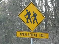
Just a small day hike today, just to get out and play in the nice weather. We started out in Harriman State Park on route 106 at an unmarked parking area (more like a pull-off), you will see yellow-blazes on the guardrails and trees. Using the NY/NJ Trail Conference map 118, we headed up the yellow-blazed Suffern-Bear Mountain trail on the same side as the parking area. What a great little hike! No rocks! Mountain laurel! Nice (this time of year with no leaves) views! In less than 30 minutes you will hike to the Orak Ruin. The ruin, as the story goes, was formerly the mansion owned by George Briggs Buchanan. Mr. Buchanan was the V.P. of Corn Products Refining Co. (the makers of Karo syrup). He named his estate Orak (Karo backwards) and seemed to be a quirky fella. When he built his dining room, he designed the floor to move like a ship's cabin, he even added portholes for windows. I'd give anything to go back in time to the 1920's, all the strange history seems to come from that era. We played there for a while, a lot of the foundation is still standing, but watch your step, there are a lot of old pieces of metal laying around. Back on the trail, where at times you can view the Hudson River, it's just a short hike to a fire tower. Now (this is where my love for Sterling Forest comes in), unlike the Sterling Forest fire tower, you can't get near this one. But, boy! is it big! After staring in awe of its size, we just followed the fire tower road back down the mountain until we met up with the yellow-blazed trail again. Retracing the trail back down, we stopped once again to play in the ruins, but this time, some small cabins across from the Orak ruin. Then we followed the trail back to the road, but now we crossed the road and followed the yellow-blazed Suffern-Bear Mountain trail the other way toward the "Irish Potato". Again, a very relaxing, easy hike. Just follow the yellow-blazed trail as it ascends Irish Mountain. At the summit, you will find the largest boulder you have ever seen, this is the Irish Potato. It's more impressive when you take a picture of someone standing next to it for proportion. After playing with the rock tripe on the boulder, we headed back down, following the yellow-blazed trail back to the car. Not a big hike, but I didn't break any bones, and in my book, that's always a good day.
Sunday, February 8, 2009
Orak Ruin
Labels: New York
Subscribe to:
Post Comments (Atom)


9 comments:
Rock Tripe is fascinating!
Sounds like my kinda hike. Let me know when you want to go there again on a warm day!
It's too bad you didn't go up the fire tower. You can go right up to it, and the view is great!
http://www.flickr.com/photos/harrimanhikers/505697409/
http://www.flickr.com/photos/harrimanhikers/461108457/
Perhaps you saw the telephone and radio antenna towers, which you can't get to, just before the fire tower. They are big!
Wow, Greg! Thanks for the info! That means another trip is a must (not a bad thing!). We saw everything fenced and locked, so we headed back down the mountain. Thanks again.
We have to hike to the fire tower.....
I hate to disappoint you my friend...
Before I do, I will say your write-up was a very good one and I liked it a lot. You made a mistake, however, but maybe you can do this hike again and my information will help you...
Here's the deal - what you called the "fire tower" is NOT the fire tower. That is a huge cell phone tower. It is private property and it is marked on my Harriman trail map as "KO" for "Keep Out", because it is privately owned by the company that put up the cell site.
When I got that far I, like you, thought that was the fire tower. I decided to go further on the yellow trail and I found the REAL Fire Tower.
The REAL Fire Tower is an old style climb-up-the-stairs to a high-up, enclosed lookout platform. I don't know the Sterling Forest one but I would bet money that this one is similar. It's about a 10th of a mile past the cell tower you saw.
I climbed up about halfway and just as I got above the treetops, the wind really whipped up (it was a very, very windy day - gusts up to 40 MPH on the ground, I can't imagine how strong it was up there, probably more). The very strong winds combined with the fear of heights that set in because you're all alone on this little stair case up there caused me to turn back and go back down. But even from 2/3 of the way up the fire tower the views were incredible!
So next time you do that hike, if you do it again, go PAST the cell tower and you will find the actual FIRE TOWER. :)
I hiked there and was able to climb the fire tower on a clear day. What a view! To the south you can see the NYC skyline and to the north east the Hudson River including Hook Mt.and Indian Point. Be careful going up the steps, but don't miss the view.
John M.
Hi Jersey Johnny,
Please see Greg's comment and my response. Here at Northeast Hiking we are proud to be human and make mistakes, get lost, break bones...see it's not about the hike, it's about the adventure!
Hi John M,
L&O was able to go back and climb the tower, said it was amazing. I will have to make my way back over there soon. Thanks for visiting!
Post a Comment