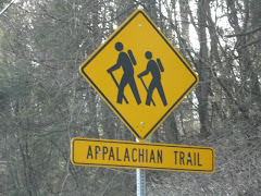
Just a shout-out to our new blog friend: http://www.bikinghikingwithkids.com/
Eric, the blog owner, has some great info on his site. Please stop in, have a cup of tea, take a look around, and support our fellow outdoor blogger.

Another fine guest post by L&O.....

Thanks L & O!
High Tor, Little Tor and South Mountain Park and Gurnee County Park
All Long Path
Map 112-Hudson Palisades Trails
7-1/2 miles
With my irreplaceable hiking partner “Northeast Hiking” diligently earning her degree in Ecology, I am sadly hitting the trails without her. I parked my car on a turnoff on Route 9W and Route 304 and crossed Route 9W to connect with the Long Path. The first mile or so is mainly road walking (Scratchup Road), however, the trail is surrounded by beauty on both sides; an apple orchard and the amazing rock cut from the Tilcon Quarry. I also spotted a few deers in the orchard. I followed the Long Path until it reached Old Route 304, then I followed the LP blazes as they turned right off the road and steadily climbed toward High Tor Mountain. The renowned author/playwright Maxwell Anderson, a long time Rockland County resident wrote a play entitled High Tor after the mountain. After a long climb, I encountered the Spur Trail, which leads to the historic High Tor Vineyards. I trudged along, opting to go explore the Vineyards another day. Steadily, I climbed until I reached High Tor Mountain. The views were amazing, and included the Hudson River and the Village of Haverstraw. During the American Revolution, the troops used High Tor Mountain as a place to signal. There are the remains of an old radio tower and lots and lots of graffiti. I descended High Tor Mountain and followed the LP to a lovely woods road. I followed the woods roads for what seemed to be two miles and found the White Trail which leads to Little Tor. The view from Little Tor was not as dramatic as High Tor, but well worth the short hike. I doubled back to the Long Path and continued on the woods road until I reached Central Highway. I crossed Central Highway and continued on the Long Path. The trail here gets more technical and steadily ascends. The ascent brings you to the Gurnee County Park with its amazing vistas. Although the signs posted on the trees warned me to “Do Not Approach, Ground Unstable” I took a peek and was rewarded with a view of the Rampo Mountains and Harriman State Park. The Long Path descends pleasantly to Gurnee County Park. I followed the Long Path onto Route 45 and rewarded myself with a nice breakfast at the Mt. Ivy Diner.

Just a small day hike today, just to get out and play in the nice weather. We started out in Harriman State Park on route 106 at an unmarked parking area (more like a pull-off), you will see yellow-blazes on the guardrails and trees. Using the NY/NJ Trail Conference map 118, we headed up the yellow-blazed Suffern-Bear Mountain trail on the same side as the parking area. What a great little hike! No rocks! Mountain laurel! Nice (this time of year with no leaves) views! In less than 30 minutes you will hike to the Orak Ruin. The ruin, as the story goes, was formerly the mansion owned by George Briggs Buchanan. Mr. Buchanan was the V.P. of Corn Products Refining Co. (the makers of Karo syrup). He named his estate Orak (Karo backwards) and seemed to be a quirky fella. When he built his dining room, he designed the floor to move like a ship's cabin, he even added portholes for windows. I'd give anything to go back in time to the 1920's, all the strange history seems to come from that era. We played there for a while, a lot of the foundation is still standing, but watch your step, there are a lot of old pieces of metal laying around. Back on the trail, where at times you can view the Hudson River, it's just a short hike to a fire tower. Now (this is where my love for Sterling Forest comes in), unlike the Sterling Forest fire tower, you can't get near this one. But, boy! is it big! After staring in awe of its size, we just followed the fire tower road back down the mountain until we met up with the yellow-blazed trail again. Retracing the trail back down, we stopped once again to play in the ruins, but this time, some small cabins across from the Orak ruin. Then we followed the trail back to the road, but now we crossed the road and followed the yellow-blazed Suffern-Bear Mountain trail the other way toward the "Irish Potato". Again, a very relaxing, easy hike. Just follow the yellow-blazed trail as it ascends Irish Mountain. At the summit, you will find the largest boulder you have ever seen, this is the Irish Potato. It's more impressive when you take a picture of someone standing next to it for proportion. After playing with the rock tripe on the boulder, we headed back down, following the yellow-blazed trail back to the car. Not a big hike, but I didn't break any bones, and in my book, that's always a good day.
To hike the route we did, visit: www.nynjtc.org/trails/record/080703.html
Well, my favorite hike was the Ricketts Glen Falls Trail, I need a least favorite, and this would be it. Well, to be fair, it wasn't all bad, let me start at the beginning.
First, DO NOT attempt to park on State property before 9 am (even if the gates are open). I know you hikers like to get out early, but since NY can't tax it; they prohibit it. And, I think the High Point employees were helping out in NY the day we hiked. Yep, just plain not nice!
So, finally allowed to park, off we went. The hike to Gertrude's Nose was amazing. It was relaxing and well maintained with spectacular views. That's L&O in the picture to the left, it was a perfect day!
Then we left the cliffs. GRRR! When Gertrudes Nose Path ends and the Millbrook Ridge Trail begins the hike turns deadly (okay, no one died, but I did fall back on my pack and like a turtle I couldn't get up! That could have been bad). Seriously, for most of the hike back to the parking area the trail is not really maintained. The path is overgrown, not well blazed, and follows a water run-off trail, which means a lot of rocks and moisture, a deadly mix for sprained ankles.
Wait, sorry to interrupt, but I have to tell you this! A few weeks ago I requested that the house I live in get real recyclable containers from the county, so I wouldn't need to make my own anymore. Well, the genius from upstairs just came downstairs, once again, to argue with me that not only is recycling a scam, but polystyrene (a.k.a. Styrofoam) is the most biodegradable material on earth. LOL, welcome to my world! This is why I like to hike, it's peaceful, beautiful, and no (or very little) people! Okay, back to the hike!
Before you attempt this 8+ mile hike (some guides claim 8 miles, some 9), remember that you actually hike down to Gertrudes Nose, so on the last end of the loop, it's all uphill. Had you been hiking the day we were, you would have heard me complaining about this for at least 2 miles
A little background, Gertrudes Nose is a part of the Shawangunk Ridge (a.k.a. The Gunks). It's a ridge of mountains in Ulster County, Sullivan County and Orange County in New York extending from the northernmost point of NJ to the Catskill Mountains (and yes, High Point is included in the Gunks, it explains a lot, huh). Known for it's rock climbing, the ridge has also been designated by the Nature Conservancy as one of the "75 Last Great Places on Earth". I would agree with the last statement, it was beautiful, just not a great hike, there's a difference.

I'm not quite sure what to say about Ricketts Glen State Park, I'm still speechless from the experience. By far my favorite hike, the 7.2 mile, difficult Falls Trails leads hikers past 21 waterfalls ranging in height from 11-feet to 94-feet, all are amazing in their own way.
If you park in the trailhead parking on Rt.118, called the Evergreen Trail Lot, the entrance to the Falls Trail is directly across the road. For an added bonus, another waterfall, the 36' Adams, is located at the end of this parking area.
Ricketts Glen Natural Area is a National Natural Landmark comprised of 13,050 acres in Luzerne, Sullivan, and Columbia counties.
Bring lunch, a good camera, and sturdy boots (the trails get very wet and slippery). The hike itself is very challenging, but I didn't fall once, so that's a good sign!
For more info, visit:
http://www.visitpaparks.com/


John Muir traveled most of his life. Born in Scotland on April 21, 1838, John's first grand adventure was as a boy immigrating to the United States. John fell in love with the Sierra Nevada when he first traveled to California in 1868. While making California his home, John also traveled extensively in Alaska and throughout the West, keeping journals and writing books and articles on the beauty that he saw and the need for mankind to preserve it.
One often wonders how their life will be remembered. John Muir had no such worries. Yosemite National Park exists because John Muir helped establish it in 1890. And if you travel to California, Alaska, Florida, Washington, Wisconsin, and Dunbar, Scotland, you will find geographic locations named after Muir. John also helped establish the Sierra Club as well as being the first president (a position he held unitl his death in 1914). And he happens to be the man standing on the back of the California State quarter. That's a hell of a legacy to leave behind.
So as you celebrate the National Park Week and Earth Day this month, remember the man who spoke for the trees well before anyone else, even the lorax.
Happy Day, John, thank you.

No, not the kind with thumbs....the ones with eight legs...ewww!
Yup, March actually marked the beginning of tick season and with all the rain we've had, the woods are ripe to pick a few of these guys up.
A few reminders:


The 326 mile Long Path begins at the Fort Lee Historical Park in New Jersey and ends at the John Boyd Thacher State Park in Albany County, New York (work is continuing to extend the trail north with a terminus in the Adirondacks).
Although every effort was made to keep the trail away from towns, the path travels through many, giving the hiker an intimate look at the heart of New York.
One such town that the trail passes through is the historic Nyack, the Gateway to Rockland County. Home to the Tappan Zee Bridge, a stop on the Underground Railroad, and the keeper of the Helen Hayes legacy, Nyack attracts many to its shore. Street fairs and celebrity sightings are as much a way of life to the residents as are the endless streams of tourists who overtake this small town every summer.
Following the Long Path through Rockland County will lead you through Tallman Mountain State Park (where the trail drops to the lowest elevation, a mere 5 feet above sea level), along 9W, through Blauvelt State Park (former home to a Nike missile launch site), then entering Nyack to cross the New York Thruway for the first time. It is at the intersection of Mountainview Avenue and Route 59, at the New York Thruway entrance ramp where blood was shed not so long ago on the Long Path.
It was on October 20, 1981 in the neighboring town of Nanuet, N.Y. where the unimaginable happened.
At approximately 3:55 pm, Peter Paige, a 24-year Brinks veteran, and his partner, Joe Trombino left the Nanuet National Bank, located on the second level at the Nanuet Mall. Exiting the mall, they used hand trucks to push the $1.6 million to their waiting armored truck. As they loaded the money into the truck, a red van drove up and the rear doors flew open. Masked men jumped out of the van, while one robber used a shotgun to fire 2 blasts into the bulletproof windshield, another robber opened fire with a M-16 automatic, killing Paige and wounding Trombino (Joe Trombino survived the assault and continued to work for Brinks until he was killed in the September 11 attacks in 2001, he was 68.). The thieves grabbed $1.6 million from the truck and fled the scene.
The robbery, which took less than 2 minutes from beginning to end, was not engineered by amateurs. The masked assailants were actually Mutulu Shakur, Mtayari Sundiata, Solomon Bouines, Chui Ferguson, and Kuwasi Balagoon, members of the Black Liberation Army.
A few miles from the mall, a U-haul truck, yellow Honda, and a white Buick parked in a Korvette's lot. In the U-haul were Weather Underground members, David J. Gilbert, Kathy Boudin, Samuel Brown, and Judith Alice Clark. The red van pulled up and money bags were tossed into the U-haul and yellow Honda. Meanwhile a college student studying at home, looked out of her kitchen window, witnessed the exchange, and notified police.
Responding to the call, Police Officers Waverly Brown and Brian Lennon along with Sgt. Edward O'Grady and Detective Artie Keenan, stopped a U-haul truck at the entrance ramp of the N.Y. Thruway. Guns drawn, Sgt. O'Grady told the driver and passenger to exit the vehicle. Kathy Boudin exited the truck and pleading innocence, convinced them to lower their weapons. The officers did, after all, they were looking for black men, not a white man and woman, they must have the wrong truck. Detective Keenan, not satisfied, walked to the rear of the truck and attempted to open the door. Before he could alert the others that it seemed something was holding the door closed, the men inside jumped out of the truck opening fire on the officers.
The robbers then scattered, some in the Honda, others carjacked a motorist, Boudin attempted an escape by foot. Boudin was captured, as was Weathermen David Gilbert, Samuel Brown, and Judith Alice Clark when they crashed the Honda. Police Chief Alan Colsey kept the three held up at gunpoint until backup arrived. Inside the car, police found $800,000 from the robbery. Others escaped that day, but in the end, all were captured.
As you hike the Long Path, you will pass this small memorial to Officer O'Grady and Officer Brown as well as Brinks guard, Peter Paige.
October 20, 1981 marked the end of three lives, the end of radical organizations, and the day blood was shed on the trail.


Located in Orange County, New York, the William Brien Memorial Shelter can be found at the junction of the Appalachian/Ramapo-Dunderberg Trail and the Menomine Trail atop Letterrock Mountain.
Originally known as Letterrock Shelter, it was built in 1933. William Brien, known naturalist and first president of the New York Ramblers (1923), died on October 12, 1954.
In his will, William Brien left money to build a new shelter in the park. The shelter was built in 1957 at Island Pond, but because of vandalism, it was demolished in 1973. The Letterrock Shelter was then renamed in his memory.

"We can never have enough of nature. We must be refreshed by the sight of inexhaustable vigor, vast and titanic features." John Muir
Ringwood State Park, accessible from exit 57 off route 287, lies in Passiac and Bergen Counties near the town of Ringwood.
In 1740, the Ringwood Company owned a flourishing iron industry. The company harnessed enough power from the Ringwood River to operate a blast furnace and forges. The estate passed to Abram S. Hewitt, a well known iron master, in the mid 19th century. In 1936, Erskine Hewitt deeded the Ringwood Manor House and land to the State of New Jersey.
In 1966, the State of New Jersey bought 1,119 acres of the Skylands estate. The Skylands Manor House and Gardens were built in the 1920's by Clarence MacKenzie Lewis, a New York stockbroker and civil engineer, who made Skylands his summer home. An additional 1,190 acres were added to the Skylands section of the park in 1995.
For more information, visit http://www.njparksandforests.org/
From the Ringwood Manor House, continue south on Sloatsburg Road, then make the first left onto Morris Avenue. Follow Morris Avenue to its end at Skylands Manor, pass between two stone eagle statues and turn left into Parking Lot A.
Starting at Lot A, turn left onto the paved road and follow the white-blazed Crossover Trail. Follow the Crossover Trail until you cross over a stream. After crossing the stream, turn left at two concrete pillars onto the green/white-blazed Halifax Trail. Begin a steep ascent on switchbacks towards Mt. Defiance. An unmarked path on the left leads to an overlook at the summit.
After enjoying the view, continue on the Halifax Trail until meeting the red/white-blazed Ringwood-Ramapo Trail. Make a right onto the RR Trail and follow the trail crossing the white-blazed Crossover Trail. Pass view on a rock face, then begin a descent. Turn left onto the Blue-blazed Trail and begin a steady climb. Bear left onto the yellow-blazed Hoeferlin Trail and the climb gets steeper. Where the yellow-blazed Hoeferlin Trail meets the white-blazed Crossover Trail, we are rewarded with a spectacular view, including the New York City skyline. This is a great spot to take a break and enjoy the view.
Hoeferlin joins the Crossover Trail for a while, then Crossover Trail turns left. Turn with the Crossover Trail. Once you descend the mountain, the trail follows an old carriage road, you will pass over a waterfall, as the trail turns left, a short walk through the woods will lead you right to the base of the falls. Continue to follow the white-blazed Crossover Trail as it passes an Eagle Scout camp on the left and the green/white blazed Halifax Trail on the right, back to the parking lot. This is a moderate to difficult 8.5 mile hike, but the views and the waterfalls make it worthwhile.